This is the third of three linked blog posts produced by the NERC-funded ‘Landscape Stories’ team. (The other posts are here: Celebrating diverse connections to nature and Talking the talk: storied walks in nature).
In this post we reflect on a walk from Hambleden Mill to Henley-on-Thames in January 2023 undertaken as part of the NERC-funded Landscape Stories Project. Together, members of the ‘Dadima’s’ Community Walking Group and researchers from The Open University followed the River Thames from Hambledon Weir to Henley before looping back across the hill.
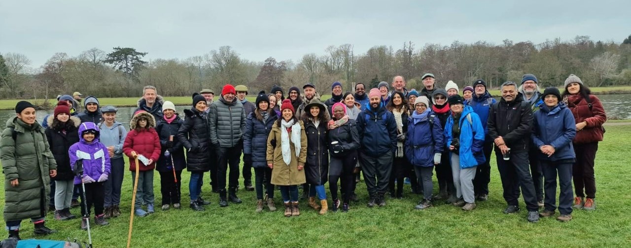
The Dadima’s Walking Group and OU team, hiking near Henley-on-Thames. Credit: Subash Ludhra.
Preparing for the walk
Through Landscape Stories we are using a storytelling approach to co-design, deliver and reflect on our storied walks, combining scientific, cultural and historical facts (Khatwa, 2019). Through mentoring, guidance and feedback from Dr Geeta Ludhra, Dr Anjana Khatwa and Professor Richard (Rick) Holliman, three environmental researchers (Professor Clare Warren, Dr Yoseph Araya and Dr Marcus Badger) further honed their skills of scientific storytelling through rehearsal, co-creative planning and reflection. A core objective of this process was to connect Earth and environmental science content, landscapes and cultural relevance for the participants attending this walk.
.jpg)
Three tales of the creative and destructive power of rivers. Credit: Geeta Ludhra.
Our theme for this walk was ‘rivers as agents of change’. As ever, Geeta coordinated the promotion of the walk (e.g. see the image to the right), offering advice and guidance on practicalities through a combination of social media and the Dadima’s Countryside Walks and Talks Programme.
This programme of monthly educational nature walks is hosted on the Chiltern’s Area of Outstanding Natural Beauty (AONB) website. (Geeta is a Chilterns Conservation Board Member; she was nominated for this role by the Secretary of State for Environment, Food and Rural Affairs.)
Rivers as agents of change
.jpg)
Anjana highlighting the creative and destructive power of rivers. Credit: Jon Barrett.
Anjana started off the walk with an introduction into the power of rivers to create and destroy as they seek to find equilibrium. She highlighted that rivers meander across landscapes transporting sediments, constantly seeking to find the easiest course. Anjana linked this idea to our own lives – the course we aim to follow is constantly knocked by outside influences, some of which are overwhelming and life-changing, but will evolve back to a new balance.
As we walked from Hambleden Mill to Henley-on-Thames, we paused periodically to hear three tales from the riverbank. Marcus presented a “Tale of three rivers” – telling the stories of the current Thames, the Ancestral Thames, and the Bytham river over the last 500,000 years. Clare discussed the role of river erosion and sediment transport in delivering both benefits (fertile soil) and drawbacks (naturally toxic elements) to humanity. Yoseph told a story of floods and droughts, linking his dry homeland of Eritrea to the wetter, more temperate climate of England. Towards the end of the walk Anjana offered reflections on the three storied walks, and on rivers as agents of change.
A tale of three rivers (Marcus Badger)
I started my talk with reference to the Ancient Greek philosopher Heraclitus of Ephesus who almost said, “No one ever steps in the same river twice, for it’s not the same river and they’re not the same person”. Whilst I’m not a Greek philosopher, I think the point he was making was about the importance of time, both for the river and the person, and for rivers the point is even more important when thinking about geological time.
My story explored the geological history of two rivers and the powers of creation (and a little destruction) that led the Thames to be where it is located today.
We are used to thinking about the Thames as one great river, but it wasn’t always like that. The Thames didn’t always flow from its current source in the Cotswolds through to the Thames estuary.
We are probably all used to thinking about the courses of rivers changing. In my talk, I recalled geography lessons in primary and secondary school, learning about meanders and oxbow lakes. Having a geography teaching mother, I remembered how oxbow lakes would be pointed out to me as we drove to visit nan and grandad.
But the changes I discussed are much greater than the formation of an oxbow lake.
I was referring to the creation of the current river Thames tens of thousands of years ago, and the destruction of its two forebears – the ancestral Thames and a river most people have probably never heard of called the Bytham.
If we were walking from Hambleden Mill to Henley-on-Thames 500,000 years ago we wouldn’t be standing beside the Thames. The river that drained the area near Henley-on-Thames was much further north in the Ancestral Thames.
Further north still, in Warwickshire between Rugby, where I live, and Coventry, the River Bytham flowed. Together, these two great rivers travelled to the north sea a different way – the ancestral Thames flowing through what is now Clacton before crossing more dry land in what is now the north sea, and the Bytham entering somewhere north of the Wash in what we know think of as Lincolnshire. I used a map to illustrate the location of these two ancient rivers.
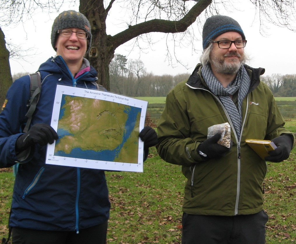
Clare shows a map of two ancient rives; Marcus shows evidence of river gravel. Credit: Kate Ashbrook.
I noted that it was the Anglian Glaciation that destroyed these two rivers. A layer of ice, in places over a kilometre thick, blanketed everywhere north of a line that ran from Hornchurch, past Aylesbury to Moreton-in-Marsh. As the ice eventually melted, a new river emerged, running much further south of where it once did and creating the beginning of what we now call the Thames.
I asked how geologists know that the path of the river changed. The answer is evidence from river gravels where there aren’t rivers. The Thames today drops sediment along its path, and those two great rivers once did the same.
But today, where two mighty rivers once ran, only echoes of them remain in the form of these gravels. I shared around examples of river gravels to illustrate this point.
Uncovering the secrets of river sediments (Clare Warren)
I started my story by explaining that I am a geologist, specialising in rocks that have formed deep under mountains, under very high pressures and temperatures. My “geological home” lies high up in the mountains, in the Himalaya, the Alps, and the eroded portions of ancient mountain belts in Norway and Scotland. As such, I feel less comfortable, as a geologist, in this part of England, covered in chalk, sand and mud. The banks of the River Thames, less than 100m above sea level, are about as far away from my geological home as you can get.
I went on to explain that there is a link between the mountains and the lowlands: they are linked by rivers. Slowly but surely, over millions of years, rivers erode away the mountains and carry their remnants downstream as particles of sand and mud. The Thames starts its journey to the sea only 110m above sea level and carries sand and mud downstream where they are left on floodplains when the river floods. The floodplains along the Thames owe their fertility to thousands of years of mud being washed downstream.
I explained that I have worked for many years in the Himalaya. Rivers that have their headwaters thousands of meters high in that mountain belt provide water and fertile agricultural land to millions of people living on the plains and deltas of India, Pakistan and Bangladesh. But these rivers, the Ganges, Brahmaputra and Indus, also carry a toxic natural payload from the mighty mountains.
The mud eroded off Himalayan rocks are full of a mineral called mica – it’s the glittery stuff that provides the shimmer in most natural makeup. But Himalayan mica hosts a dirty secret – it contains arsenic. And arsenic is poisonous. A large dose will kill you, which those of you who have ever read any Agatha Christie novels will know, but small amounts taken in over many years also build up over time and can cause cancers.
I handed round some samples of granite, which contains mica. While locked up inside the mica, I emphasised that the arsenic is harmless. But over geological time, when stored in layers of mud and sand carried downstream by rivers, the micas break down and release their toxic payload into the groundwater.
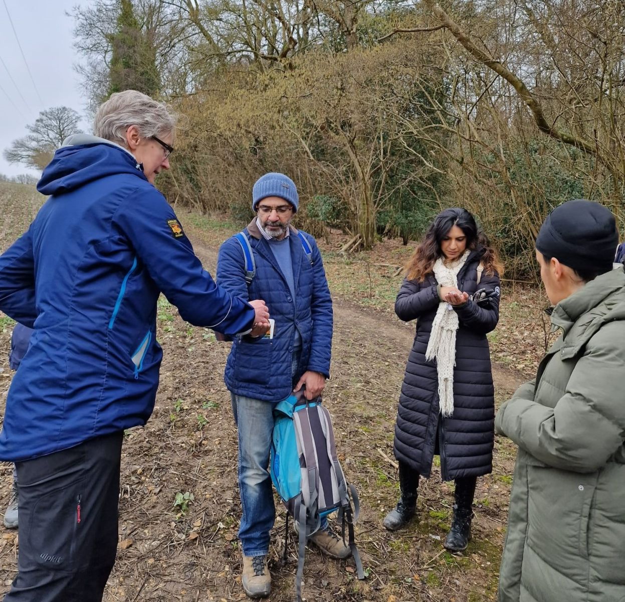
Clare hands round samples of granite, which contains mica. Credit: Geeta Ludhra.
In the 1970s and 1980s, wells were sunk into the Indus and Bramaphutra deltas to provide clean drinking water. (Wells were sunk because the alternative, river water, was very contaminated by human activities.) But little did the well-diggers know that the underground water was also toxic. Arsenic was not an element that was measured when the well-water quality was tested. As a result, over time hundreds of thousands of people have been affected by drinking arsenic-laced water.
I ended my talk with the reflection that rivers can both create and destroy. They provide rich, fertile, well-watered soils that provide us with food. But they can also destroy, through flooding and contamination.
The importance of managing flood water (Yoseph Araya)
I started my talk on how I appreciate the sight of people walking in nature, riding narrow boats, fishing, etc. along the calm rivers in the UK. I compared this relaxed setting with the awe and fear I had of seasonal rivers that sent dangerous and sudden flash floods in Eritrea, where I grew up. Fast forward to the present day, and old habits die hard. I still wouldn’t wade into a river. However, I have developed a more nuanced view of fast-flowing rivers and flooding.
Part of the reason for changing my views is to do with my ecological research in rivers of temperate climates. This has increased my awareness of how rivers that flood bring water and essential nutrients to vegetation.
Some species of vegetation thrive in flooded systems. They have special adaptations to overcome specific challenges, e.g. bulrushes (Typha latifolia) ‘snorkel’ in flooded areas, allowing them to ‘breath’ under water. Moreover, water helps spread their seeds around while also helping to keep aggressive grasses from dominating over slower growing sedges. The flood water also acts as a ‘blanket’ to keep soils warm and alive when all freezes in winter.
The subtle gradients of flooding and mosaic of water availability near water bodies are thus behind the rich species diversity of wet meadows. People depend on those as they are highly productive, e.g. farmers for hay production. Wetland areas also have a conservation and aesthetic value for humans, e.g. providing wildlife sanctuaries for iconic birds such as red shank, lapwings and curlew. The water also provides a good breeding environment for various invertebrates.
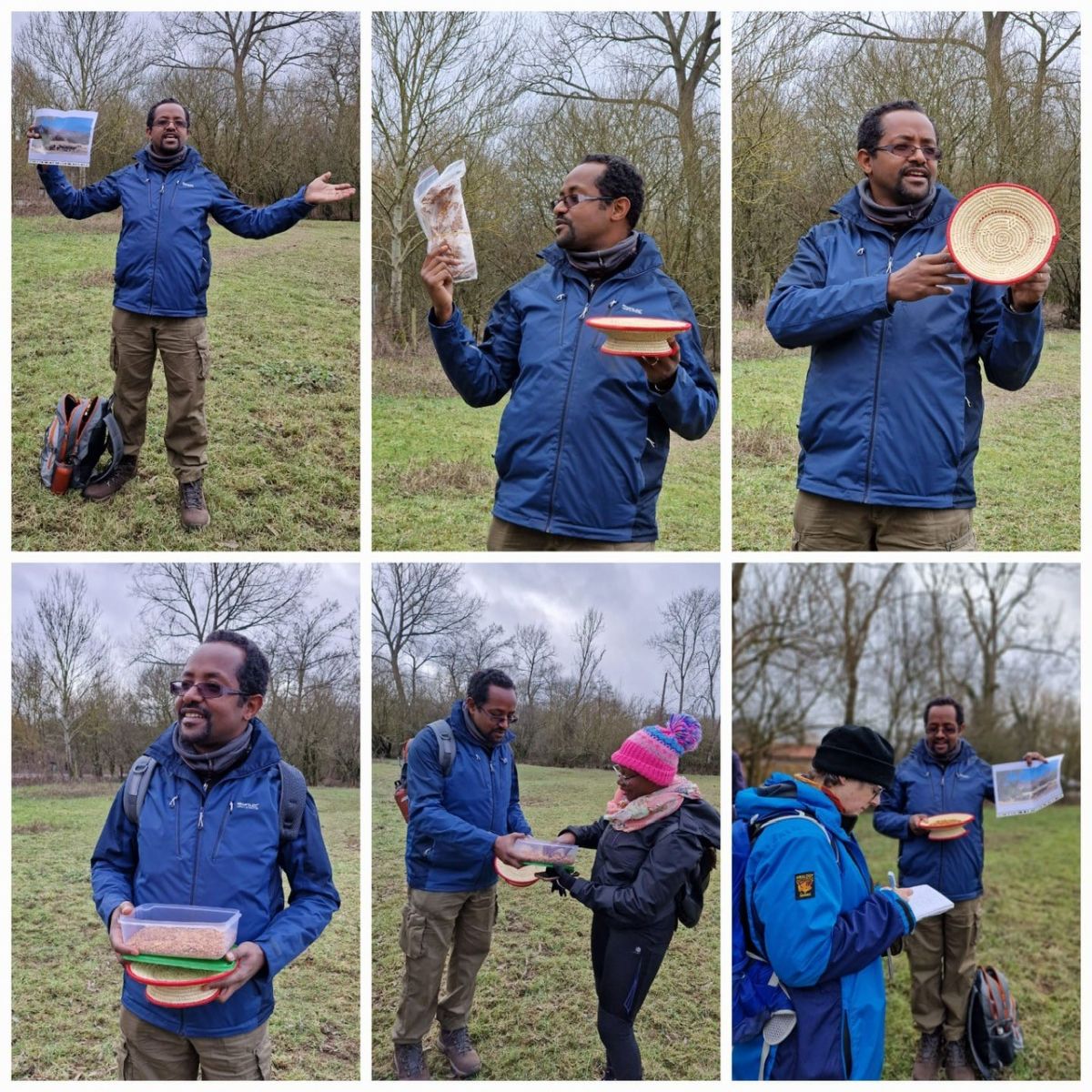
A photo montage of Yoseph delivering his talk. He is holding a traditional bread basket with roasted barley snacks. Credit: Geeta Ludhra.
In the drier, tropical climate of Eritrea, I have appreciated how the seasonal floods can help to recharge soil water reserves and allow crop growth, such as millets, over the longer dry season. Even the flood-tolerant vegetation of riverside palms and reeds provide raw material that can be used to make traditional household baskets (like plates), useful for serving roasted grain and unleavened bread.
I demonstrated one of the traditional baskets, made from riverine palm and reed vegetation, and shared roasted barley snacks. The snacks proved to be very popular.
In conclusion, I argued that well-managed rivers, and floods, can have benefits to both humans and nature. The key to this is careful management.
Reflections
Through this project, and the research conversations around it, we have developed a deeper understanding and respect for the power of storytelling as a vehicle to connect people. As the children’s author Michael Rosen argues,
“[…] when we swap stories, we are also involved in doing what has been called ‘higher order thinking’ […] At the moment of swapping, seemingly ordinary low-level chat has this capacity to make us swiftly find analogies and similarities. This is one way we try to pass wisdom between us, making generalisations through exchanging stories and anecdotes. […] we hear the moment in a story and walk through into a moment in our own lives” (extracts from Rosen, 2016).
We have found that the stories we have shared have led to further stories, creating safe spaces for conversations between walkers from Dadima’s and environmental researchers. We found that participants on the walk were willing to respond to the stories, e.g. offering anecdotes and asking questions in the context of the group, and through follow-up discussions one-to-one when walking.
This experience has made us more confident in engaging with diverse communities who are systemically under-represented in Earth and environmental science. Clare, Marcus and Rick have developed and deepened their perceptions of White privilege and practices of allyship. The collaboration with Dadima’s has helped them to reflect critically on uncomfortable issues of academic privilege. Their learning in this space has been supported through a reflexive approach and critical dialogues with Geeta, Anjana, Yoseph, and also community members of the Dadima’s walking group who have shared their stories with them.
.jpg)
Priya Ganatra and Geeta Ludhra sitting on the bench to commemorate the published work of David Bounds. Credit: Kate Ashbrook.
Not all of the stories were told by environmental scientists or members of the Dadima’s walking group. We were also delighted to include impromptu talks by Kate Ashbrook and father and son team (Duncan Gray and Reuben). Kate discussed the late author David Bounds, and we paused at a memorial bench to celebrate his books about walking in nature. We also passed a smallholding with an array of farm birds (turkey, geese and guinea fowl); Duncan and Reuben offered an interesting perspective on the birds.
In practical terms, we walked with a much larger group than we have walked with on this project up to now. As a result, our timings for the walk proved to be too optimistic. On reflection, a 10km walk with 42 people takes more than three hours, with stops for stories and to use facilities.
Next steps
We have cemented and embedded a long-lasting collaboration between OU natural scientists and Dadima’s CIC leaders, and also members of the Dadima’s walking community. Geeta and Anjana have visiting fellowships at the OU to share their research and practice in working with diverse communities. We have also advertised a PhD studentship to diversify participation in Earth and environmental science education and citizenship under the supervision of Holliman, Khatwa, Badger and Araya. In supporting applications for this studentship we have followed guidance from Leading Routes, through training from them and advice in their Broken Pipeline Report.
We are planning a further funding application to develop our work and concepts further, expanding beyond the Chilterns and training minoritised walk leaders, and exploring ways of assessing impact on participants.
Authors’ biog
This ‘storied walk’ is a work of joint authorship involving (l-r): Yoseph Araya (@YNAraya), Anjana Khatwa (@jurassicg1rl), Richard Holliman (@science_engage), Marcus Badger (@climate_badger), Geeta Ludhra (@educatinggeeta), Clare Warren (@geologyclare), and Subash Ludhra.
The authors are members of the NERC-funded ‘Landscape Stories’ Project and are staff or affiliated visitors in the School of Environment, Earth and Ecosystem Sciences (EEES) at the Open University.
Funding
‘Landscape Stories’ is a public engagement project funded by the Natural Environment Research Council (UKRI/NERC) to: 1) build capacity of researchers to engage innovatively with members of the public; 2) inspire public audiences with environmental science and 3) trial approaches to public engagement.
Landscape Stories has been informed by work completed on an earlier NERC-funded Project called Walking the Walk.