You are here
- Home
- Innovative project aims to reduce flood risk sustainably on a global scale
Innovative project aims to reduce flood risk sustainably on a global scale
The Landscape Senor-Based Monitoring Assessment using Remote Technologies (SMART) project is comprised of experts from The Open University, University of Stirling, Cobra Collective CIC and the North Rupununi District Development Board.
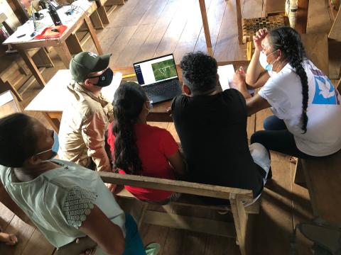
Initially, SMART will demonstrate market potential in three sites: Firth of Forth (Scotland), Colombo urban wetlands (Sri Lanka) and North Rupununi wetlands (Guyana) and then roll out globally.
Real-time flood forecasting in countries such as the UK relies on combining digital elevation models with river data to map the extent of flood events. This is often slow and expensive and in most cases river water levels provide an inaccurate picture of actual flood extent.
For countries that do not have an extensive river stage monitoring network, the understanding of surface water flood extent is even poorer.
This is a significant barrier to managing risk, improving planning decisions in relation to the location of developments, and to delivering effective investments in terms of flood defence, particularly the location of nature-based solutions that deliver multiple environmental and societal benefits.
The initiative, which is to run from 1 August 2021 to 31 March 2022, is funded by the UK Space Agency’s (UKSA) ‘Partnership in Innovation Development’ (Pin2D) designed to deliver innovative space solutions that have commercial application in both the UK and overseas.
Dr Andrea Berardi, Senior Lecturer in Engineering and Innovation at The Open University, explained the significance of the project:
“With escalating climatic disruptions, flooding is exposing many vulnerable communities to life-changing and life-limiting impacts. Space technologies such as satellite remote sensing are increasingly being deployed to adapt to and mitigate extreme flood events. Yet, flood monitoring technologies tend to be dominated by technical specialists and applied uncritically.
“If these technologies are to be used to support vulnerable communities, then these need to be co-designed by those affected and the technology tools need to be made accessible to them. Our SMART project is a ground-breaking initiative that transforms accessibility, control and use of space technologies for flood monitoring so that these can be championed and sustained by communities themselves.”
Dr Alessandra Marino, Research Fellow, International Development and Inclusive Innovation (AstrobiologyOU) elaborated on how crucial this technology could be on a global scale, particularly in combatting health challenges caused by flooding:
“SMART democratises access to surface water monitoring to support local and community-led decision-making in Scotland, Sri Lanka and Guyana.
“Surface water mapping is key to address several challenges, from flooding to the detection of breeding sites for mosquitoes carrying deadly diseases. Timely detection of changes to water bodies can inform better management of important ecosystems, such as wetlands.
“In this partnership, The Open University has coupled its expertise in the space sector with its social justice mission, to deliver an accessible tool for environmental monitoring to communities.”
On the OU’s specific involvement and interest in the project, Dr Berardi added:
“The OU is leading the community co-design process of a set of online and mobile applications that will enable people to tell their stories about flood challenges and solutions, while allowing them to map their community’s assets, vulnerabilities, flood impacts and support the implementation of remedial actions.”
SMART is a follow-on project from DETECT, another UKSA-funded development that made use of satellite technology to help vector surveillance and stop the spread of malaria.
When asked where SMART might go in the future, Dr Marino commented:
“SMART is working to provide satellite maps via at least one open-source app. In the future, we aim to refine and expand the capabilities of our technology and couple it with capacity building resources to support bottom-up environmental monitoring at scale.”
Original article published on OU News 24/1/22: Innovative project aims to reduce flood risk sustainably on a global scale
Latest News
- Intern Opportunity at ESTEC 10th November 2023
- CALICO: A Future Mission Review at ESA 23rd May 2023
- Join our team as a PDRA - CLOSED 9th February 2023
- PhD studentships now OPEN for applications 1st November 2022
- Senior Fellow Position **Closed to Applications** 20th September 2022


Explore

Undergraduate
Postgraduate
Policy
-
Follow us on Social media
-


